

Leesburg, Ohio
ACCURATE WILDLIFE DATA USING
THERMAL DRONES
Thermal drone wildlife surveys delivering real deer counts, movement data, and actionable insights for hunters, landowners, and managers
Accurate, Data-driven Wildlife Surveys Using Advanced Thermal Drone Technology.
Drone Wildlife Surveys
Elite Deer Recovery provides data-driven deer herd analysis that gives landowners and hunters a clear, accurate understanding of the whitetail deer living on their property. Using advanced thermal and aerial drone technology, we conduct precise drone deer surveys that capture reliable population data across your entire property.
Each survey delivers a clear, actionable report detailing herd size, health, and distribution. Whether your goal is improving habitat, refining harvest strategies, or ensuring long-term herd sustainability, our surveys provide the insight needed to make confident, informed management decisions.
Ready to see exactly what’s living on your land? Contact Elite Deer Recovery today to schedule your wildlife survey and start managing your property with real data
Real Data from Real Properties
What You'll Receive
List of Services
-
Total Deer CountList Item 1
Get a clear and accurate count of deer across your property.
-
Buck-to-Doe RatioList Item 2
Understand herd balance to make better management decisions.
-
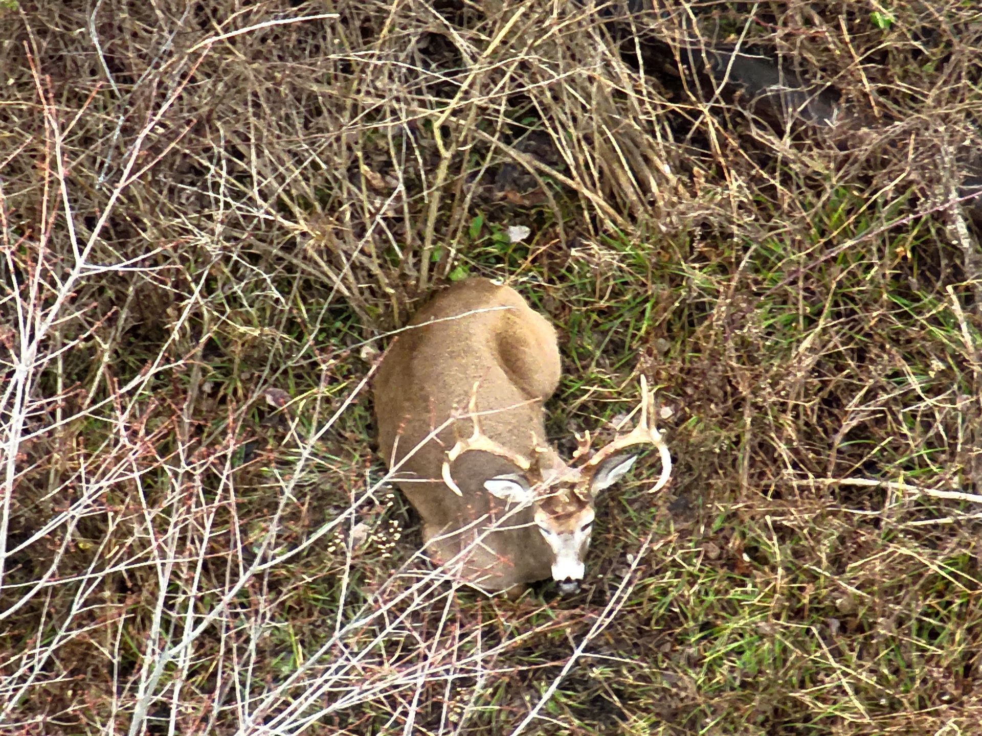
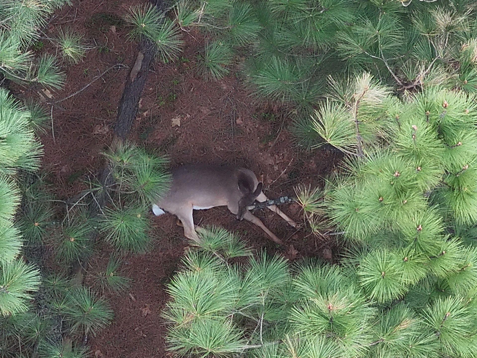
Photos of All Antlered DeerList Item 3
High-quality images of every identified buck on your land.
-
GPS Location PinsList Item 4
Precise deer locations delivered directly through OnX Hunt.
-
Advanced Map Integration
Optional integration with Aerial Wildlife Solutions maps for deeper property insights.
How Wildlife Surveys Work
Discuss Your Property Goals
We start with a conversation about your land, your deer herd, and what you want to accomplish. Whether it’s harvest planning or long-term herd management optimization, we tailor the survey to your goals.
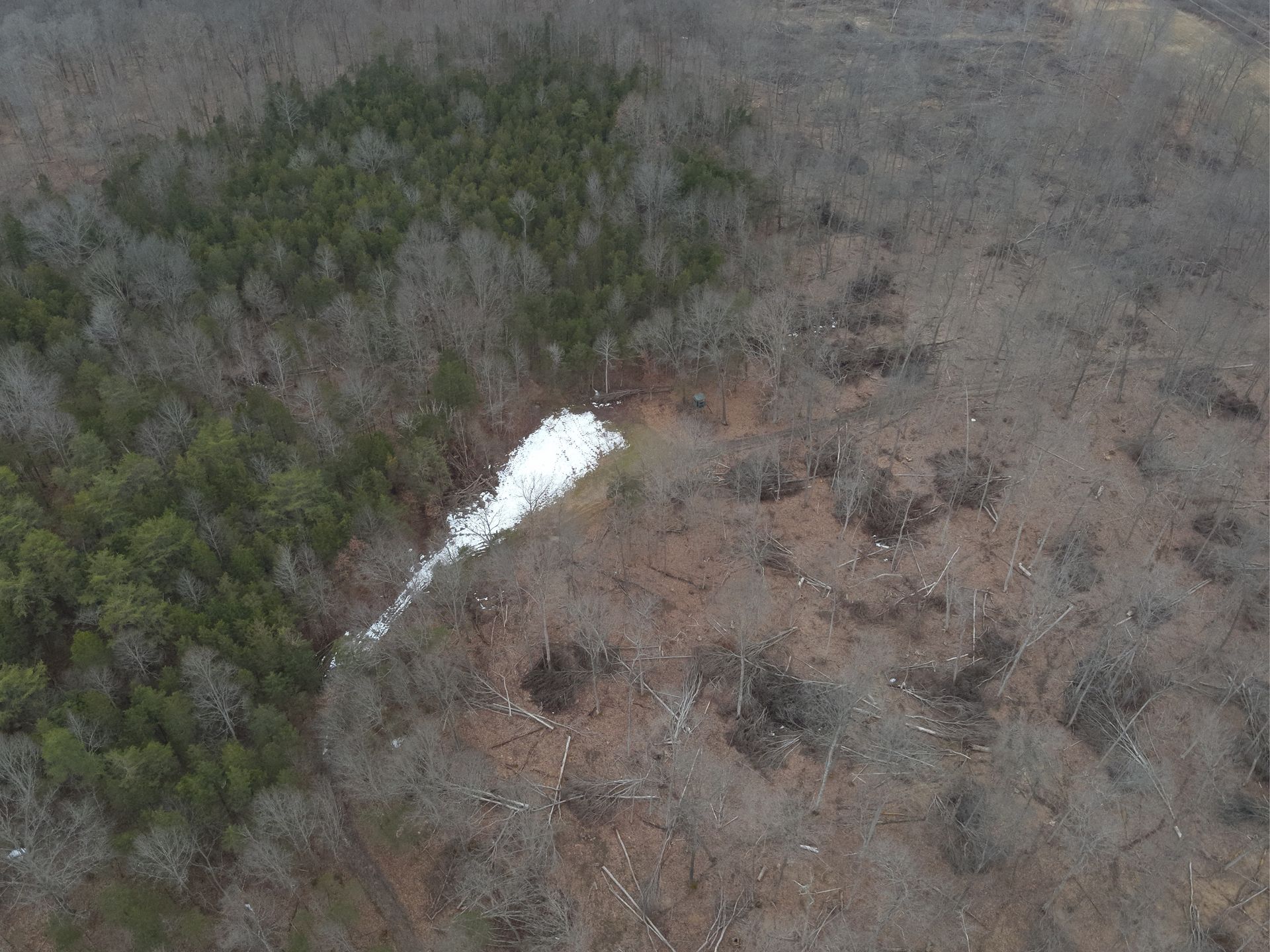
Fly & Survey Your Entire Property
Using thermal drones, we scan your property to conduct a complete deer survey. Every buck and doe is counted, marked with precise GPS coordinates, and documented for accurate herd analysis.
Deliver Your OnX Map & Report
After the survey, we create a custom OnX folder with all pins and photos. You’ll also receive a detailed report summarizing herd health, ratios, and insights, everything you need for smarter herd management.
Turn Data Into Management Decisions
You take this data and make informed management choices. When paired with our custom mapping service, the results provide valuable insights like no other giving you the tools to truly optimize your property for deer. We can complete these deer surveys multiple times throughout the season to track changes in your herd
Note: During hunting season; there is a 48-hour turnaround for deliverables.
See What Your Habitat Work Is Really Doing
Every habitat improvement you make should have a purpose, and thermal surveys allow you to verify if it’s actually working. Whether it’s TSI hinge cutting, new bedding areas, food plots, screens, or transition zones, we show you how deer are truly interacting with those changes.
Instead of relying on assumptions, trail cameras, or limited daylight sightings, you get a full-property view of real deer movement and usage. See where deer are bedding, how they’re entering and exiting food sources, and how they’re navigating your improvements.
This data allows you to make smarter decisions moving forward, fine-tune your setup, and build a property that not only looks good on a map but consistently holds and moves deer the way you want it to.
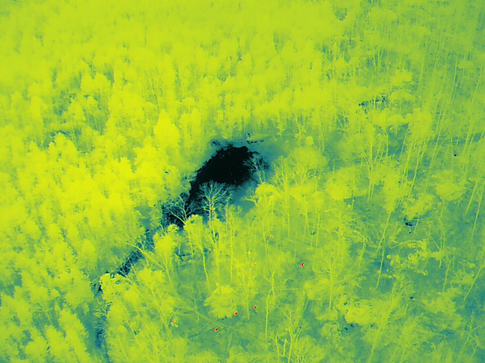
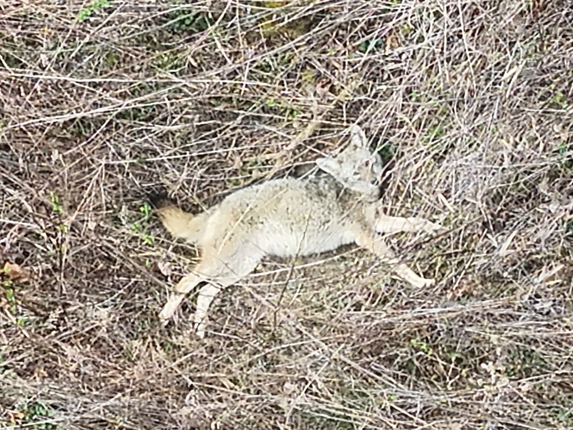
Check out some of our latest wildlife surveys
Smart Wildlife Insights
Wildlife surveys give fast and accurate insight into your deer herd. By using advanced drone imaging, we can quickly count bucks and does and map their locations. This helps landowners make smarter wildlife management decisions and optimize their property for hunting and long-term herd health.
Contact Us Today
Want to know exactly what’s running around your property? Elite Deer Recovery has you covered. We use advanced aerial drone tech to run full wildlife surveys, giving you clear data on total deer count, buck-to-doe ratios, and GPS locations.
This info is a game-changer for wildlife management and fine-tuning your hunting strategy. Call us at 937-403-8622 or fill out the form on our website to book your survey and get the inside edge on your land.