

Leesburg, Ohio
AERIAL MAPPING THAT BRINGS
YOUR PROPERTY TO LIFE
Property Visualization | Aerial Mapping Insights | Land From Above |
Map With Precision| High-Resolution Mapping
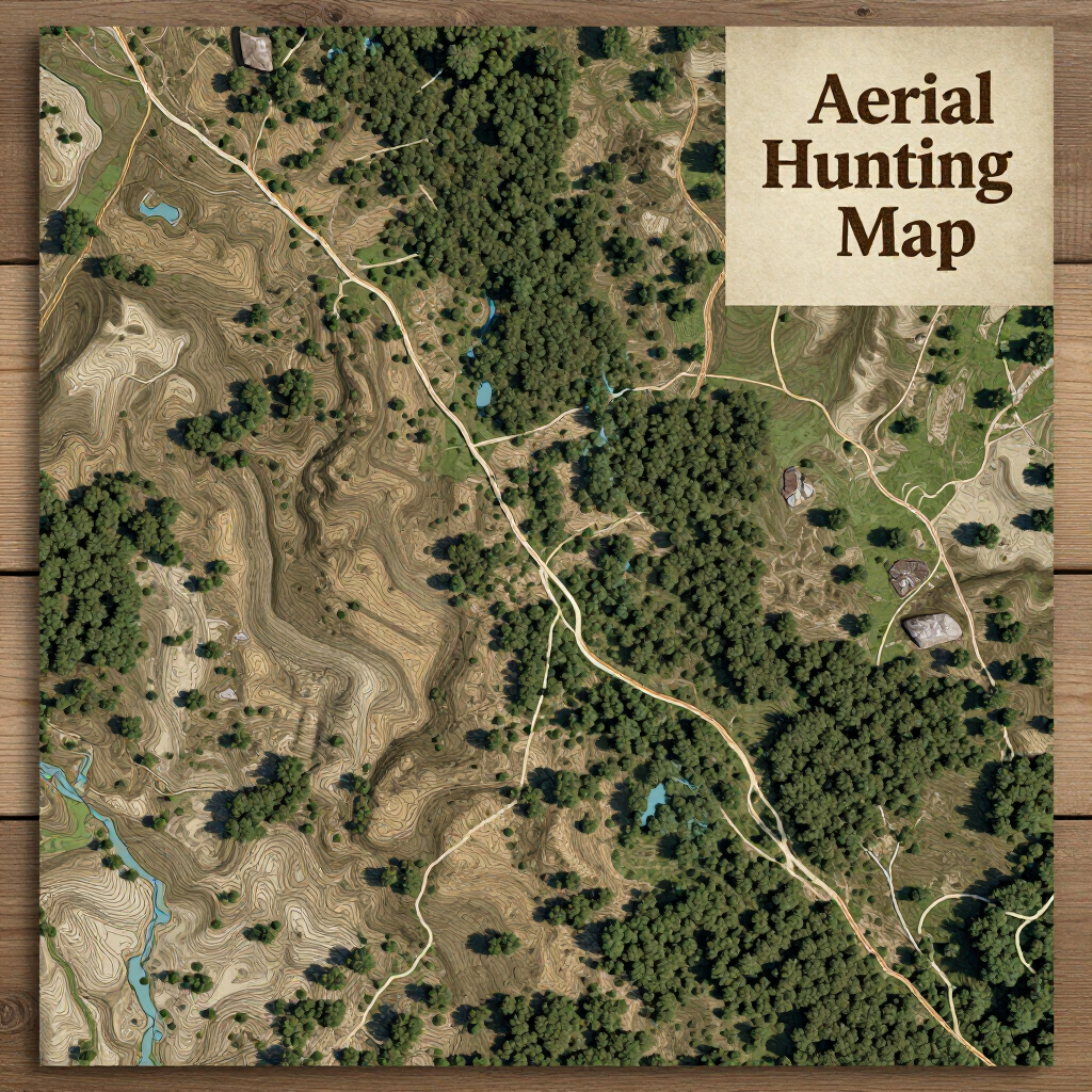
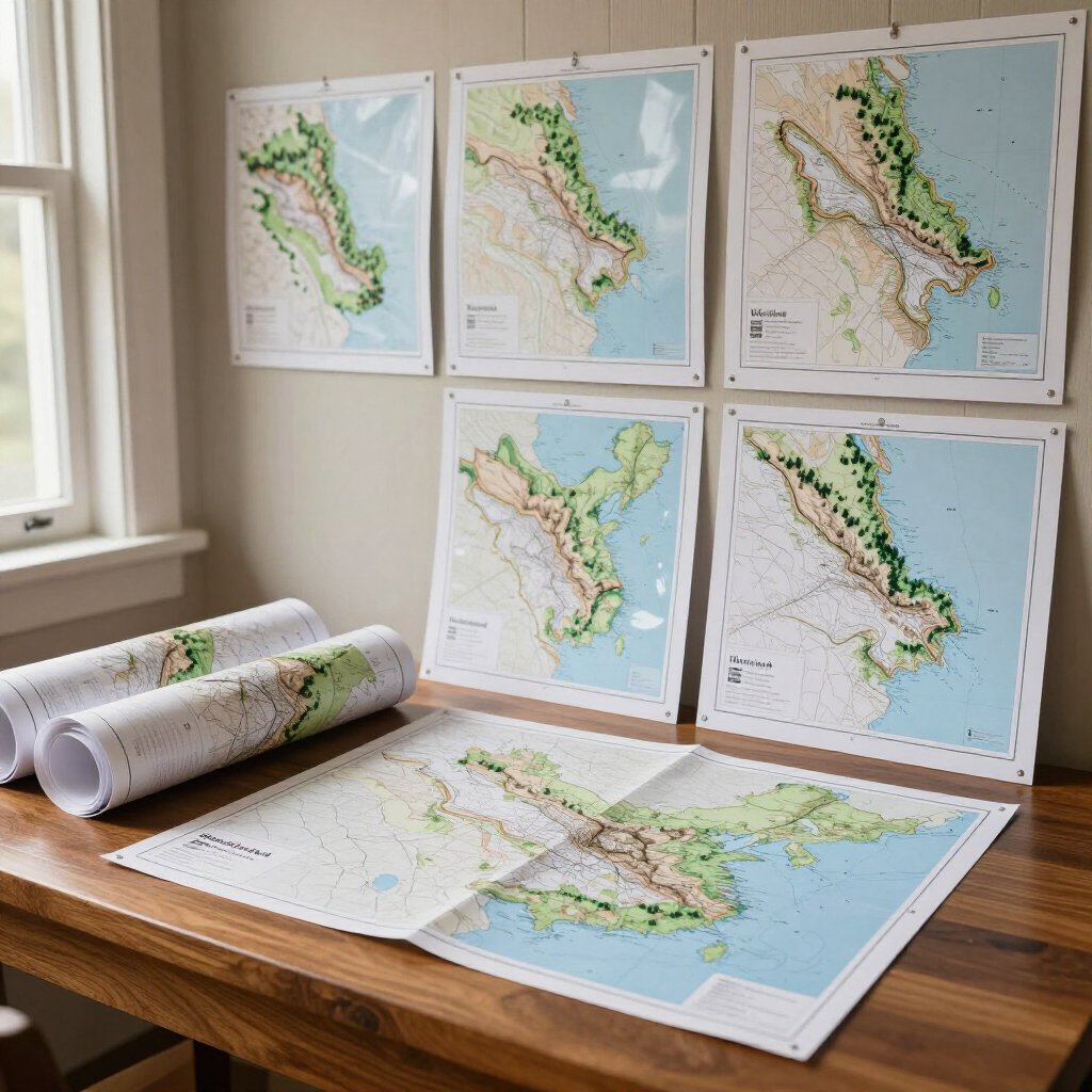
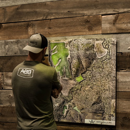
Custom Aerial Maps for Hunting Properties
At Elite Deer Recovery, we’re proud to offer the most advanced and detailed hunting aerial maps available today, powered by Everland Outdoors (formerly Aerial Wildlife Solutions). Whether you’re a landowner, hunter, or wildlife manager, our custom aerial maps deliver unmatched clarity and accuracy, helping you plan hunts, manage habitat, and visualize every detail of your property from above.
Elevate Your Hunting Game
Why Choose Elite Deer Recovery x Everland Outdoors Custom Maps?
Unmatched Detail
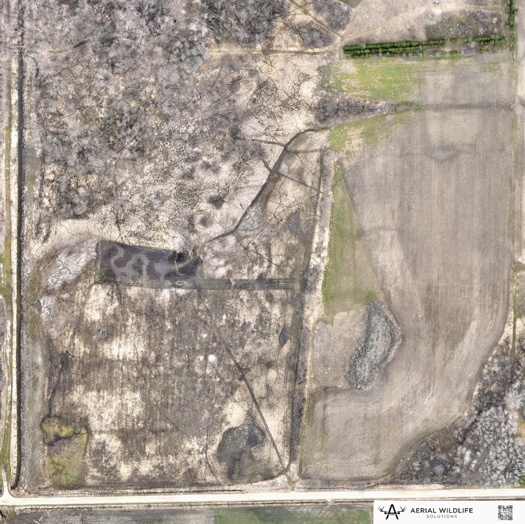
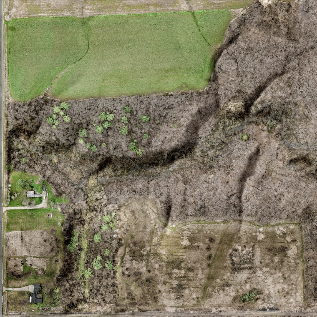
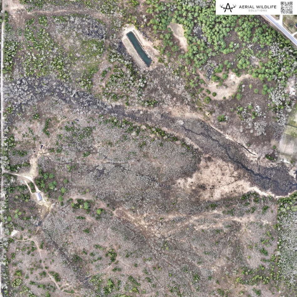
Experience your property like never before. Each aerial hunting map captures precise contours, trails, food plots, and stand locations, providing a true-to-life view that supports smarter hunting and land management decisions
Up-to-Date Drone Imagery
Our maps are built from high-resolution drone-captured aerial images, giving you the most current aerial map of your hunting property. You’ll always have accurate visuals that reflect recent habitat and terrain changes.
Multiple Custom Printing Options
Every map can be tailored to your needs — from large-format hunting maps for deer hunting perfect for wall displays, to durable aluminum and metal maps built to withstand the elements. Choose between laminate, aluminum, or custom metal map finishes to fit your exact style and use.
Precision for Every Hunter
Our custom maps are designed to enhance your hunting experience, providing the precision and detail necessary for successful outings. Equip yourself with the best tools for your next adventure.
Get Started
How Our Aerial Mapping Process Works
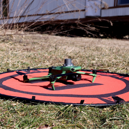
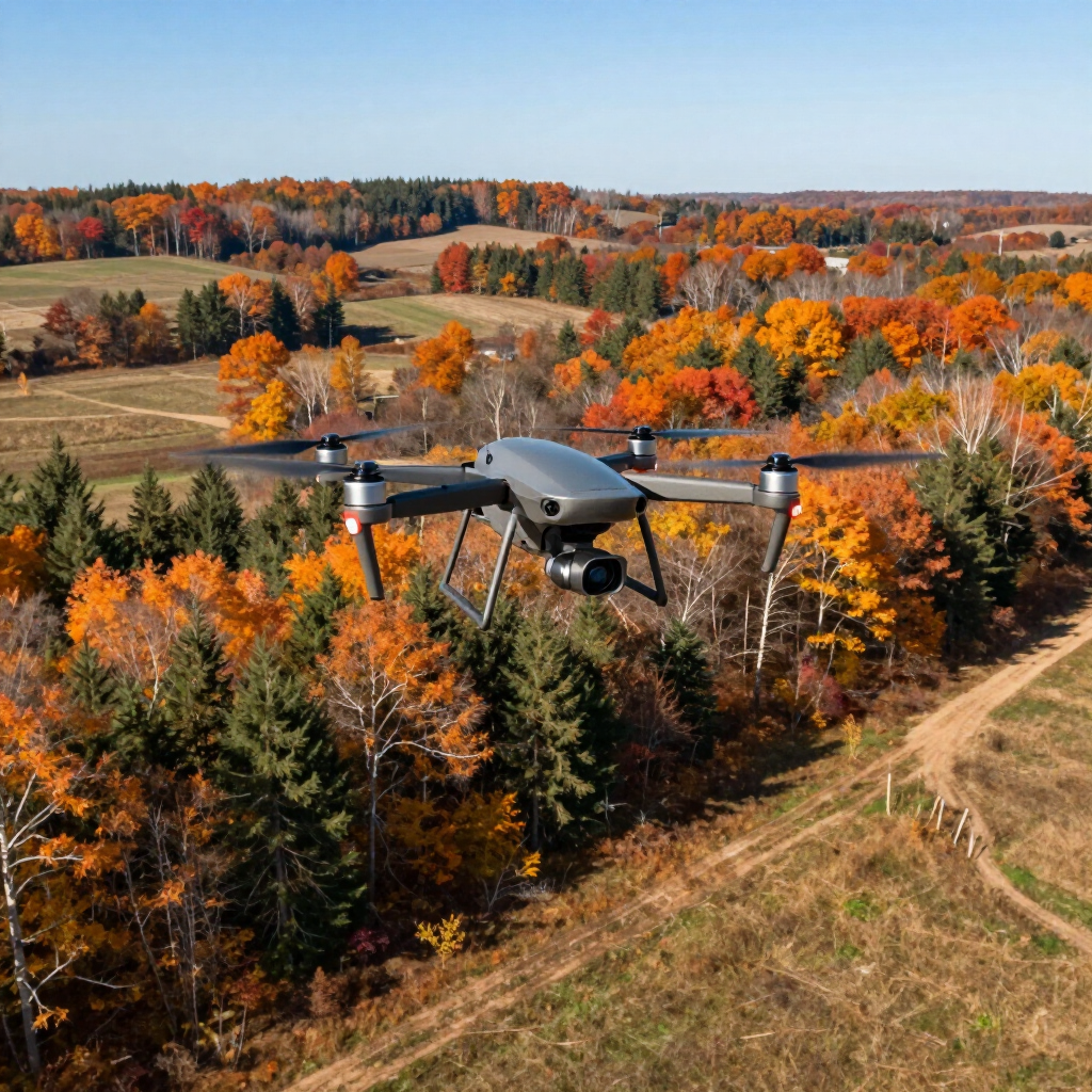
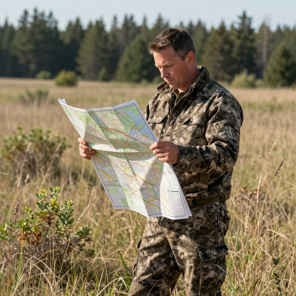
Step 1: We Fly your property
We get your property boundaries, come out to your location, and fly your property to capture high-resolution drone imagery.
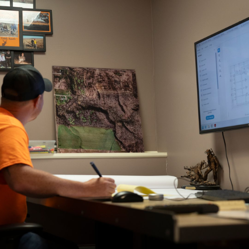
Step 2: We process and edit the Map
We process your drone imagery and build a detailed, high-resolution map of your property. We work with
Everland Outdoors to professionally process and edit each map for the highest level of clarity and accuracy.

Step 3: You choose the printing options
You choose what printing options, and we handle the rest, printing your custom map and shipping it straight to your door, ready to display or use in the field.
Step 4: Utilize and showcase your property map
Hang your map on the wall, keep it in your truck, and use it to showcase your property while planning stands, access routes, and hunting strategies all season long.
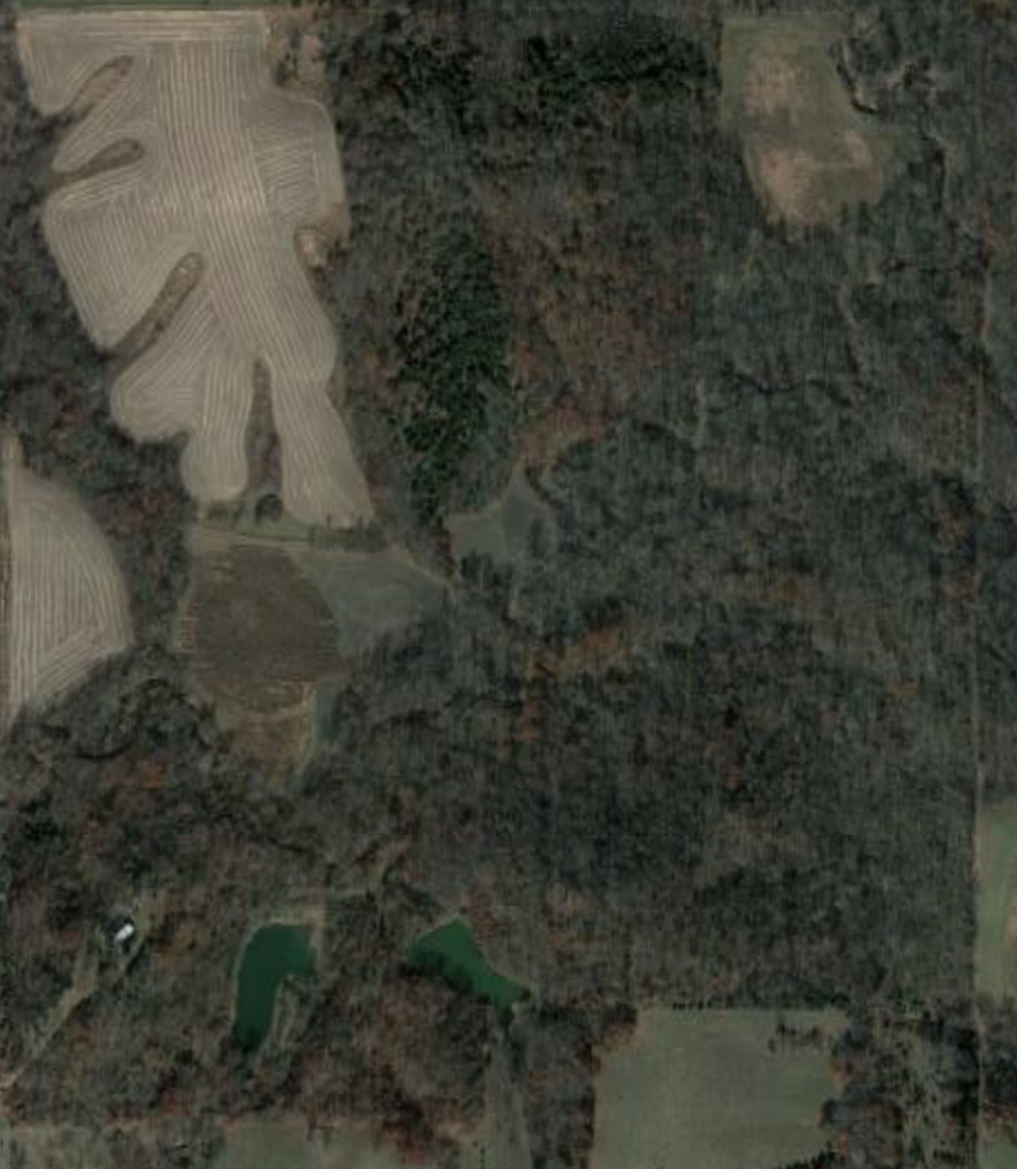
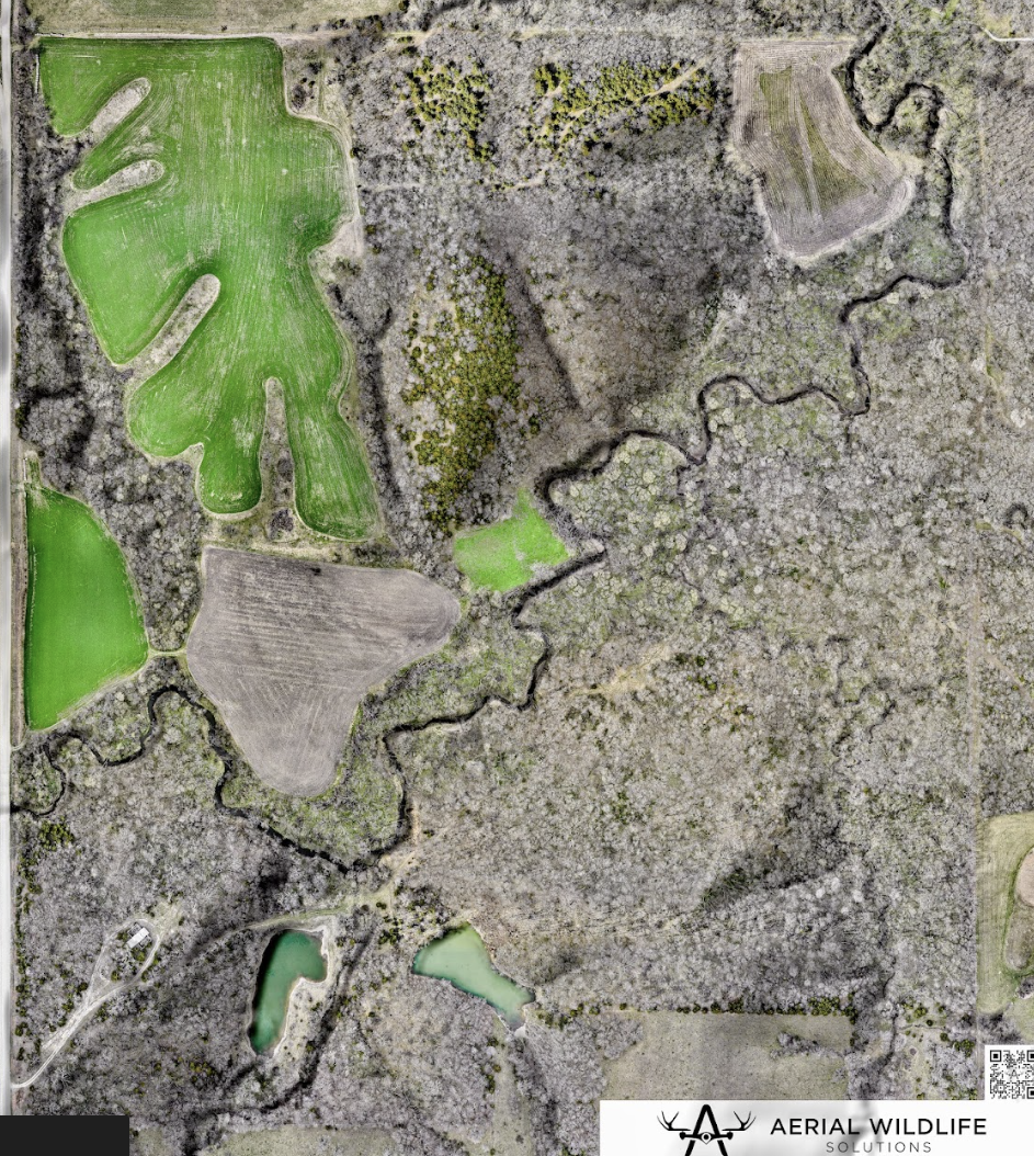
See the Difference Drone Mapping Makes
Explore our wide range of maps
Printing Options
Buggy Map
Lightweight poster paper design made for quick reference in the field or your side-by-side.
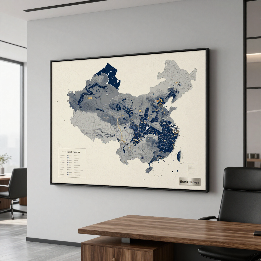
Office Map
Premium Retek Canvas option that looks great in offices, homes, or land management spaces.
Trophy Map
High-end Aluminum Print, directly printed on metal for a vivid, professional display of your property.
Pricing
Aerial Mapping Flight Pricing
Our drone mapping flights start at $450 for properties up to 100 acres, which includes a full aerial capture and high-resolution processing of your land. For larger properties, pricing is $1 per additional acre. Every flight is conducted by FAA-certified pilots using professional-grade drones to ensure precision, accuracy, and detailed imagery that highlights every feature of your property. Whether you’re managing habitat, planning stands, or showcasing your land, our maps give you the clear insight you need.
Interested in getting your property mapped? We’d love to help bring your land to life from the sky. Whether you’re looking for a detailed management tool or a wall-worthy display, our team makes the process simple from start to finish. Just fill out the form below or give us a call at 937-403-8622 to book your mapping flight and start your custom property map today.
Custom Map Printing Options
Once your map is complete, choose from our premium print options to match your style and needs:
- All-Season Map: $12 per square foot – Durable SEG material with a sleek frame, ideal for year-round use.
- Buggy Map: $15 per square foot – Lightweight poster paper, perfect for in-the-field reference.
- Office Map: $15 per square foot – Premium Retek Canvas, designed for a professional look indoors.
- Trophy Map: $31 per square foot – Direct print on aluminum for a vivid, high-end wall display.
- Magnetic Print: $35 per square foot – Interactive and functional, great for marking stand locations and planning hunts.
Each print is made with top-quality materials to ensure clarity, durability, and a stunning visual of your property.
Check Out These Short Videos to See How It Works
EDR AREA COVERAGE
Elite Deer Recovery proudly provides drone mapping and property map services across Central and Southern Ohio, including Highland, Adams, Brown, Ross, Pike, Fayette, Clinton, Scioto, Warren, and Clermont Counties, as well as Northern Kentucky and Southeastern Indiana. Our experienced team delivers high-resolution aerial maps for hunters, landowners, and wildlife managers to support smarter land management and planning. If you’re outside our main service area, simply fill out the form and we’ll connect you with a trusted drone mapping pilot in the Midwest to ensure you receive the same professional results.