
Leesburg, Ohio
Drone Recovery Services in Brown County
Thermal Drone Deer Recovery in Brown County, Ohio
Fast, Reliable Thermal Drone Recovery for Wounded or Lost Deer
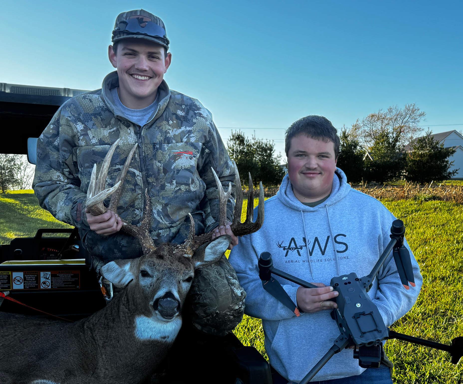
When every shot matters, you don’t want to leave your deer in the woods. At Elite Deer Recovery, we use cutting-edge thermal drone technology to locate your deer quickly and ethically—day or night.
We proudly serve hunters across Georgetown, Mt. Orab, Sardinia, Ripley, Aberdeen, and all of Brown County. Whether you're a local landowner or an out-of-state hunter, we’re ready to help recover your deer fast.

Why Use a Drone for Deer Recovery?
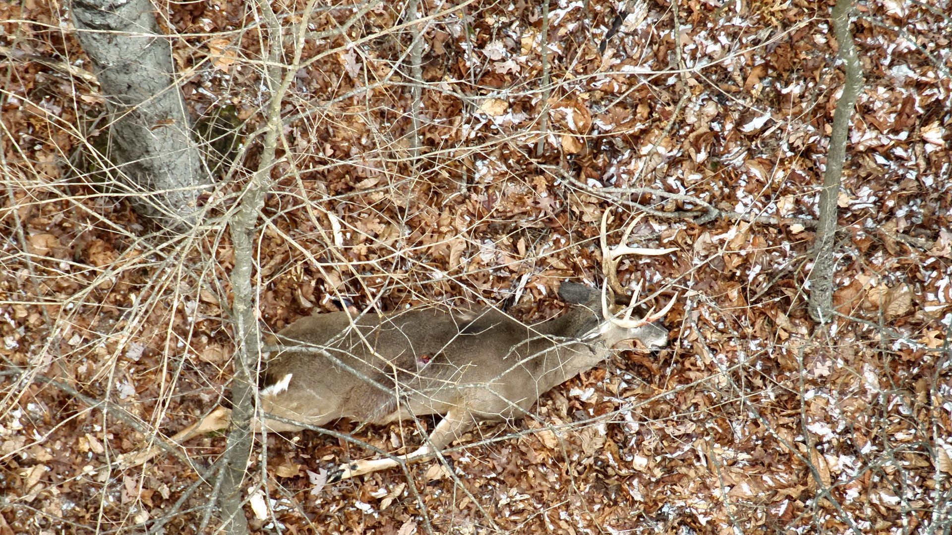
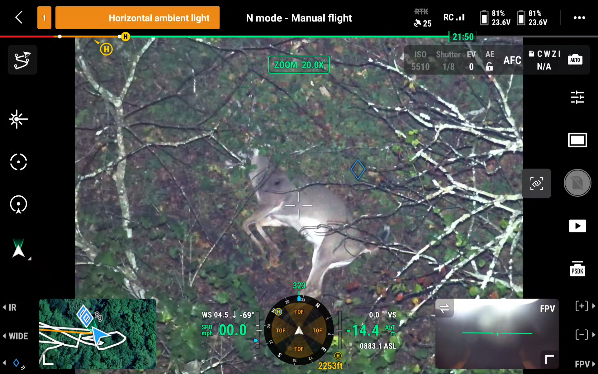
Tracking a wounded or downed deer can be incredibly difficult—especially at night or in dense cover. Our DJI Matrice 30T drone is equipped with high-resolution thermal imaging that allows us to detect body heat, even in total darkness or thick brush. Whether you’ve got a blood trail or no trail at all, we offer:


How it works
Step 1: Reach Out to Us
Whether it’s a call, text, or through our website, we’re ready 24/7 during deer season. Share your details, and we’ll ask a few quick questions about your shot and the property.
Step 2: We Make a Plan
We’ll assess the situation and create a recovery plan tailored to your property and conditions. Our team prepares the thermal drone and gear to give your deer the best chance of being found.
Step 3: We Deploy the Drone
We arrive at your location, set up, and launch our state-of-the-art thermal drone to scan the area. You can even watch the live search unfold on our viewing monitor, giving you a front-row seat as we work to locate your deer quickly and efficiently.
🦌 When We Find Your Deer
Once we locate your deer, we’ll provide you with exact GPS coordinates and set you up with directions on Google Maps or OnX Hunt. This ensures you can make a clean, direct approach to recover your trophy without unnecessary disturbance to the area.